
Nurasyl Abdrazakuly
Data Scientist with over 4 years of experience in data analysis, machine learning, and data visualization. Skilled in Python, R, and various tools like Power BI. I have developed predictive models, optimized data pipelines, and created impactful dashboards for strategic decision-making. I am passionate about crafting beautiful and insightful visualizations to make complex data understandable. As a Master of Computer Science, I am open to relocation and ready to contribute to international projects with a global impact.
Skills
Portfolio
Analytics and Visualization
This section presents data-driven analytics and visualizations designed to uncover insights and patterns. From demographic studies to geographic trends, each piece provides a detailed perspective on various aspects of Kazakhstan and beyond.
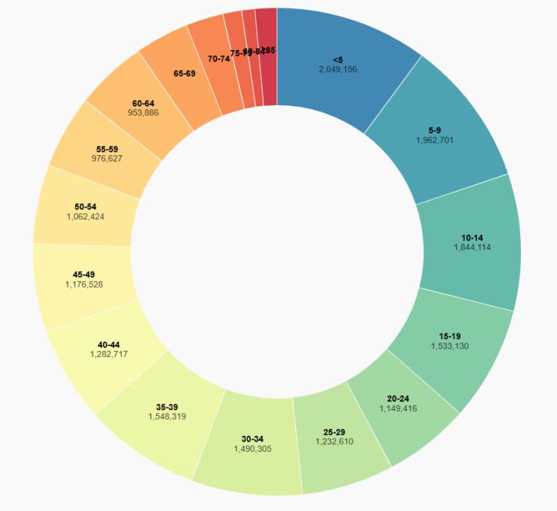
Age Distribution of Kazakhstan's Population | JavaScript
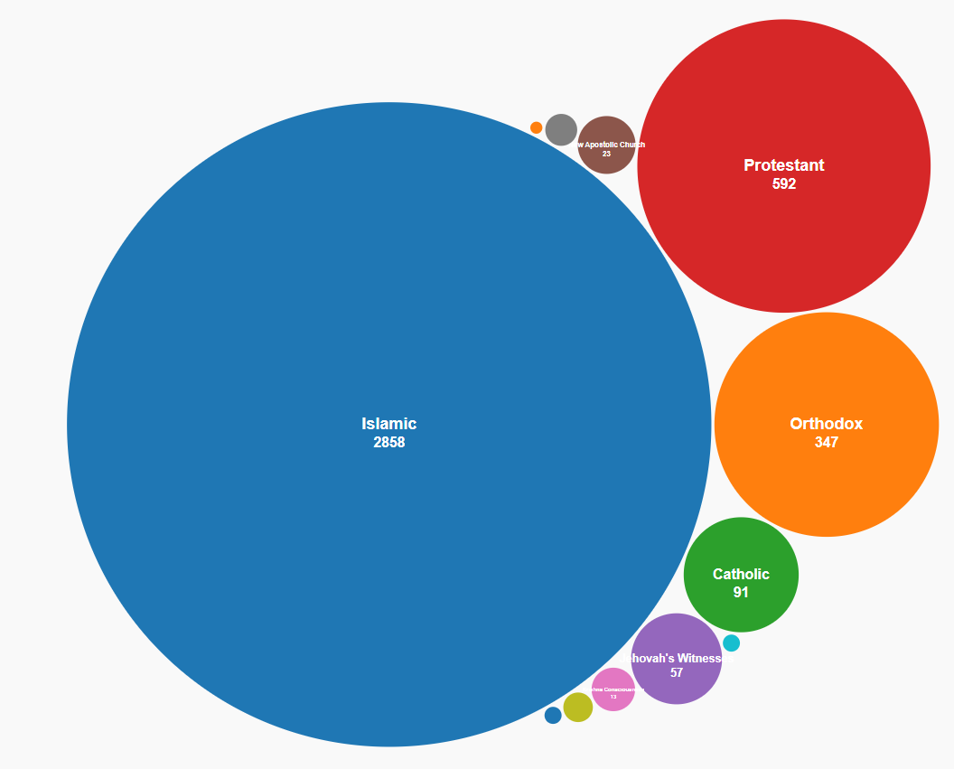
Religious Organizations | JavaScript
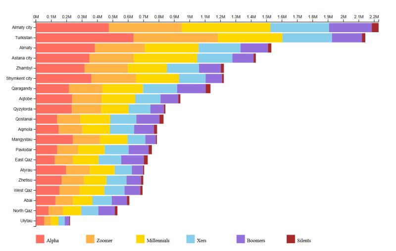
Population by Generation | R


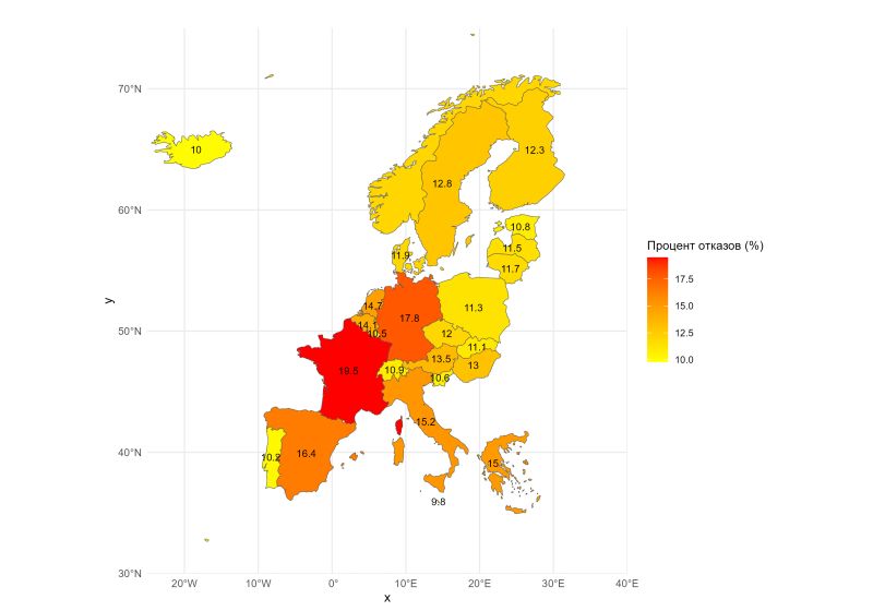
Schengen Visa Refusal Analysis | R
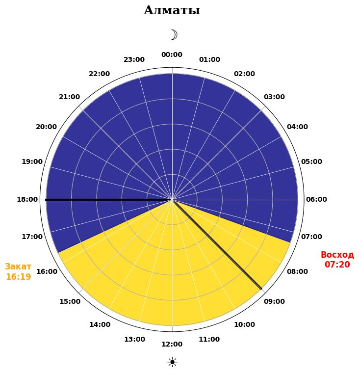
Sunrise & Sunset in Kazakhstan | R
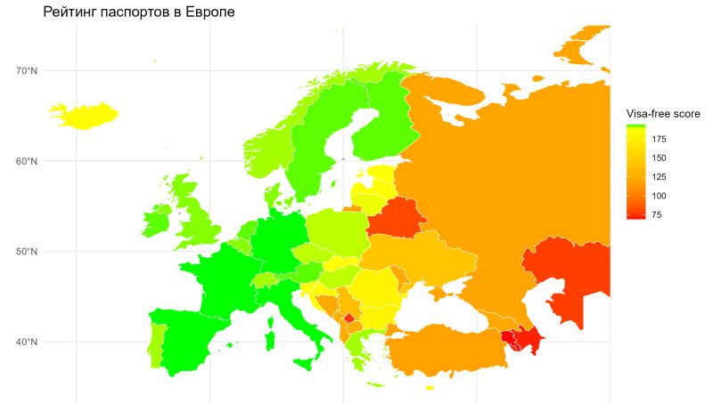
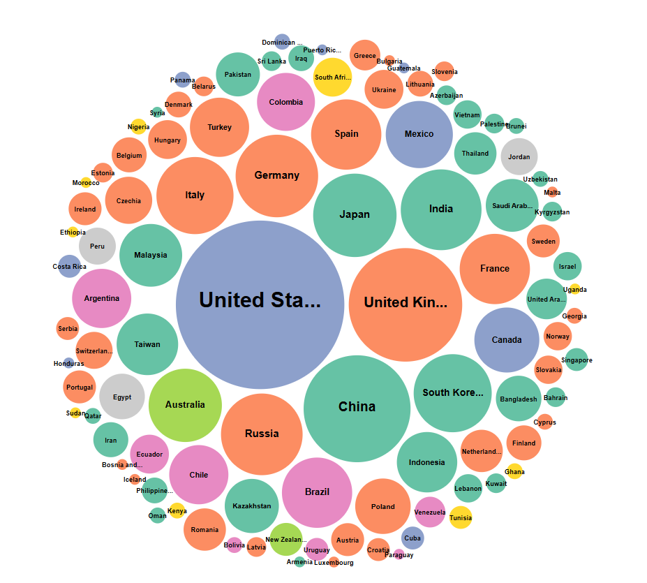
European Passport Rankings | R
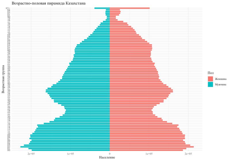
Kazakhstan Age-Sex Pyramid | R
.jpg)
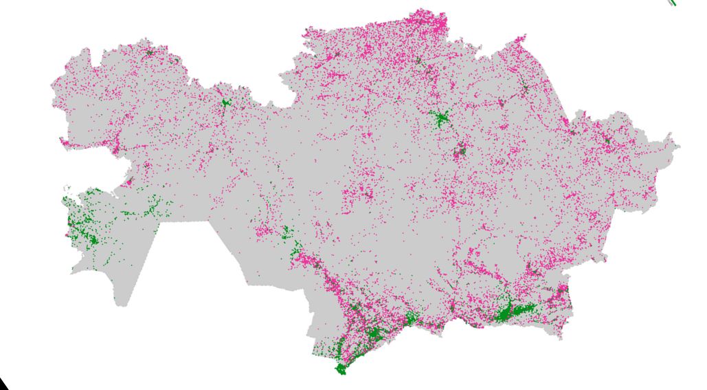
Religious Buildings in Kazakhstan | R

Population Along the Mediterranean | R

Almaty Region Roads in 3D | R

Lighthouses on the Caspian Sea | R

Railways Across Africa | R

Electricity Generation in Central Asia | R
%20KYRGYZSTAN.png)
Earthquakes in Kyrgyzstan | Seismic Risk

Ethnic Diversity in Kazakhstan | Animated

Kazakhstan Flight Network | Air Connectivity

Chemical Elements in Kazakhstan | R
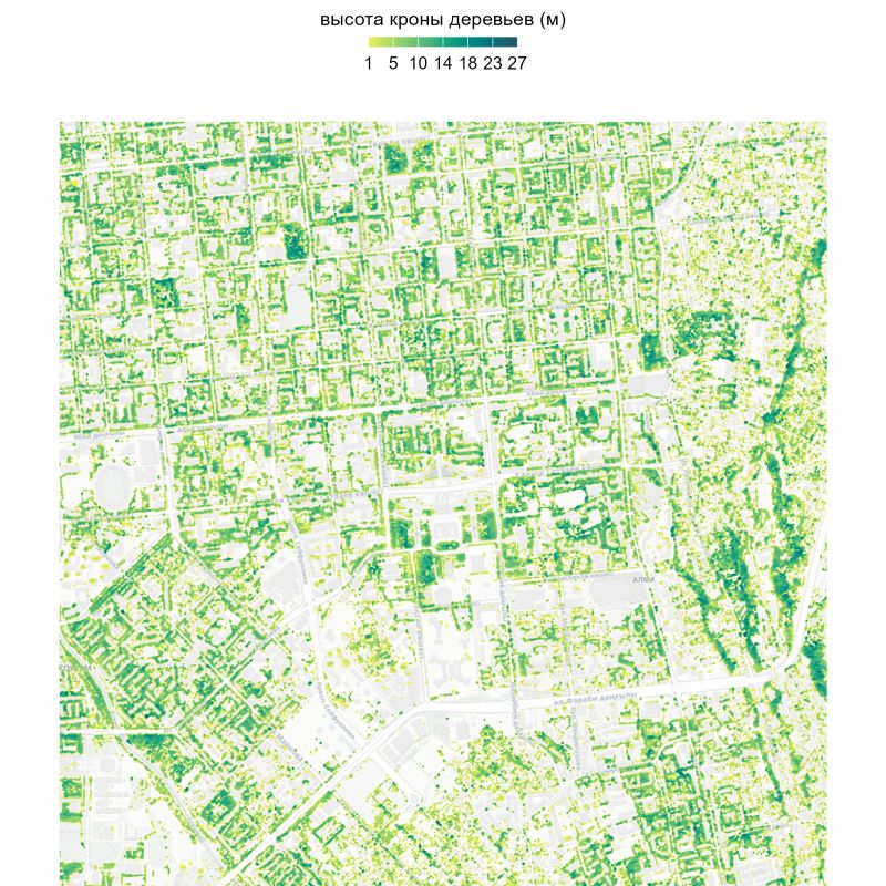
Tree Canopy Height Analysis | R
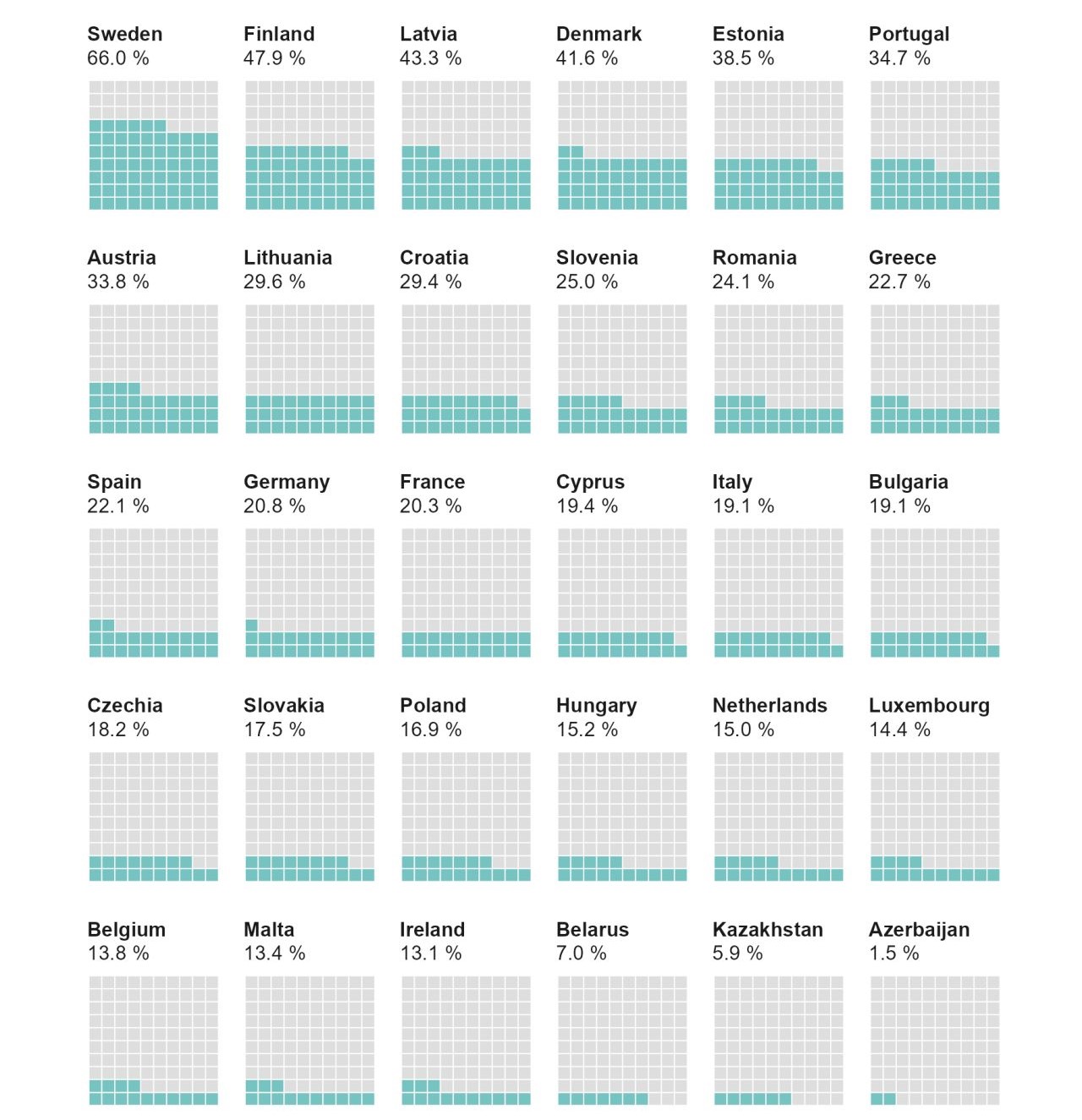
Renewable Energy Share in Europe | R
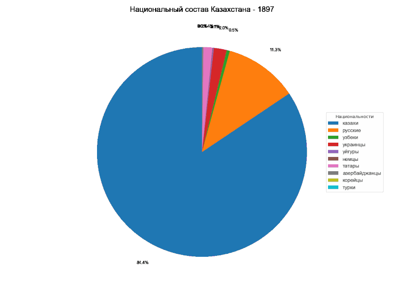
National Composition Timeline | Python
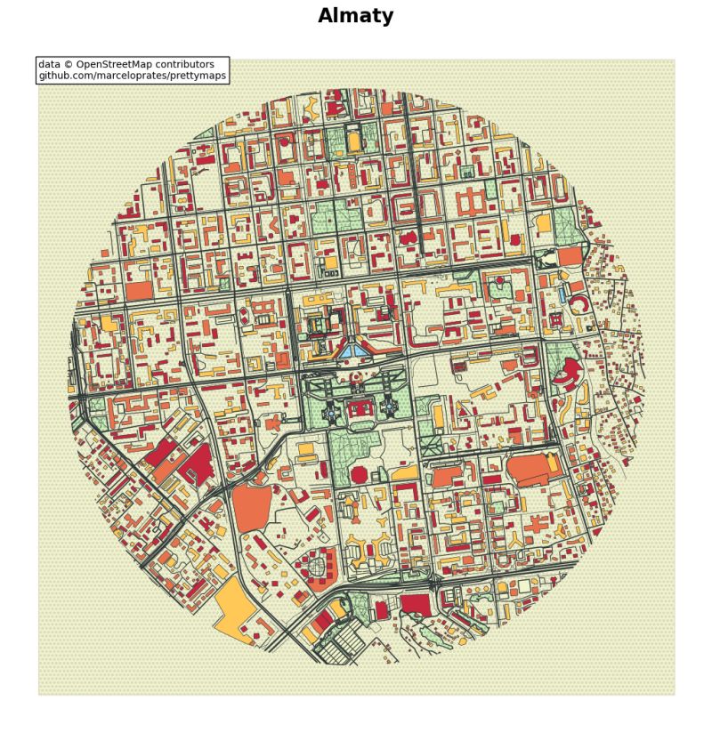
Urban Visualization of Almaty | Python
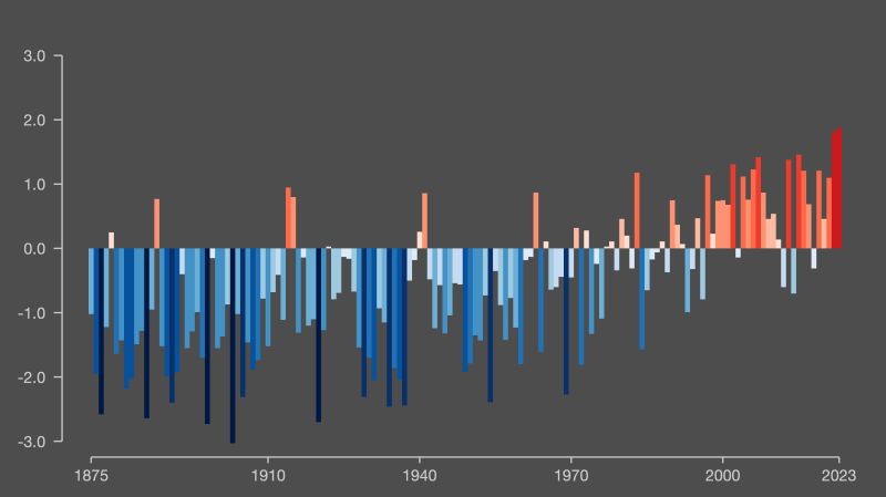
Climate Change in Almaty | R
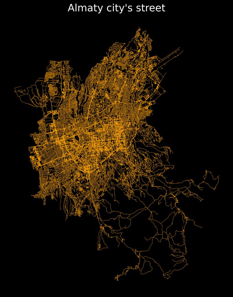
Street Network Analysis of Almaty | Python
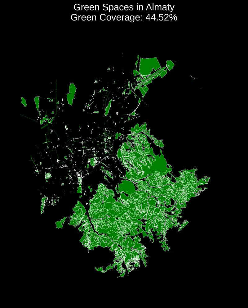
Green Spaces in Almaty | Python
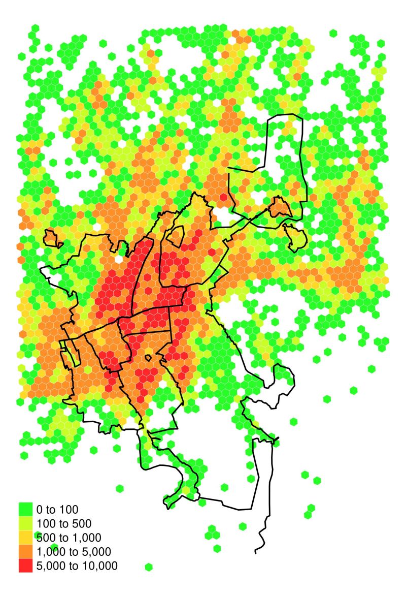
Almaty Population Density Map | R

Snow and Rain in Almaty | 2024 Precipitation
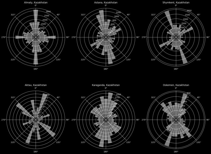
Polar Road Network Analysis | Python
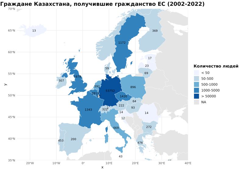
EU Citizenship by Kazakhs | Python
Geoanalysis
This section showcases geographic analysis and spatial visualizations, highlighting patterns, distributions, and key insights. From natural resources to demographic mapping, these visualizations provide a comprehensive view of regional dynamics.
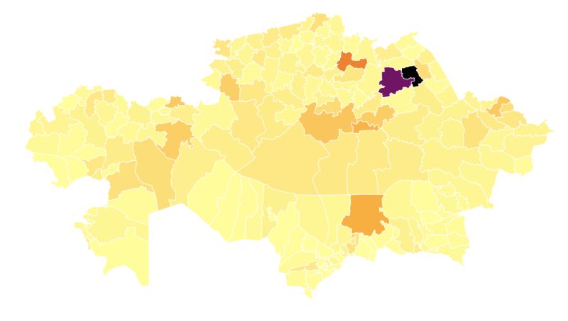
Population change map of Kazakhstan | R
Carbon Emissions Map of Kazakhstan | R
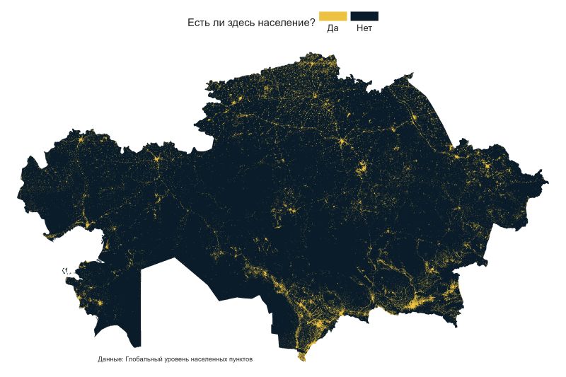
Habitability Map of Kazakhstan | R
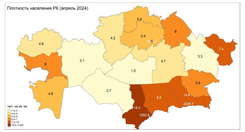
Population Density Map of Kazakhstan | R
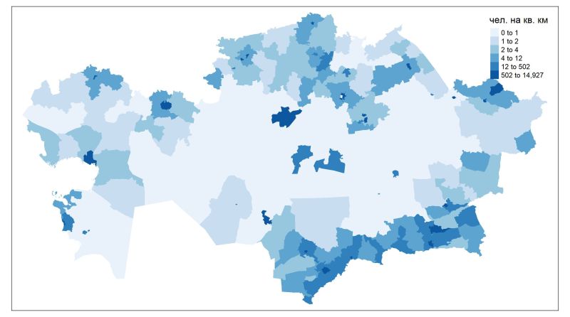
District Population Density Map of Kazakhstan | R

3D Population Density Map of Kazakhstan | R
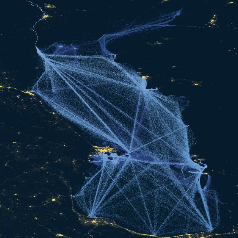
Caspian Sea Shipping Map | R


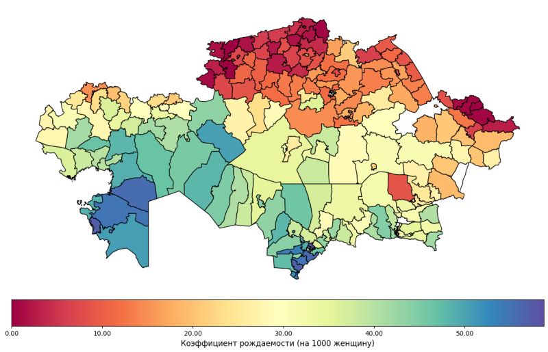
Birth Rate in Kazakhstan (2023) | R
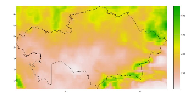
Precipitation Map of Kazakhstan | R
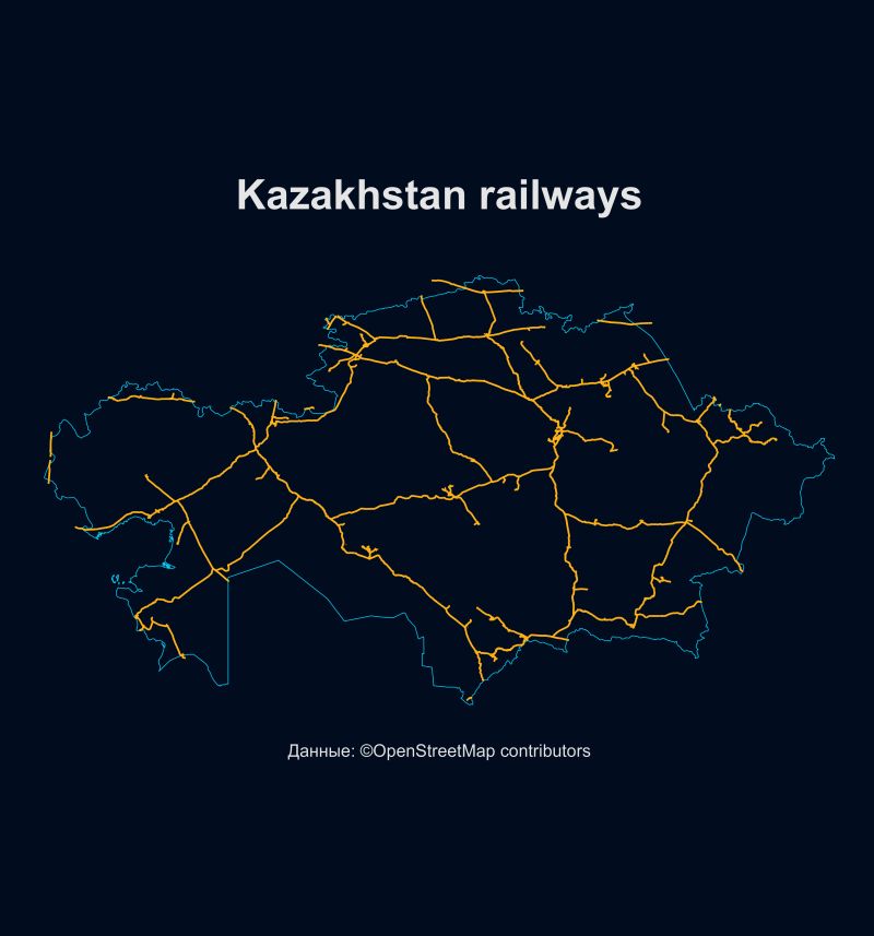
Kazakhstan Railways Map | R
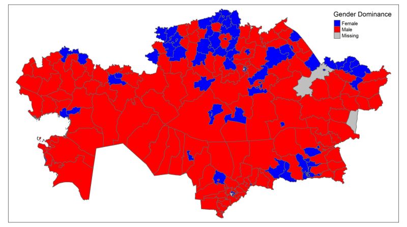
Kazakhstan Gender Dominance Map | R
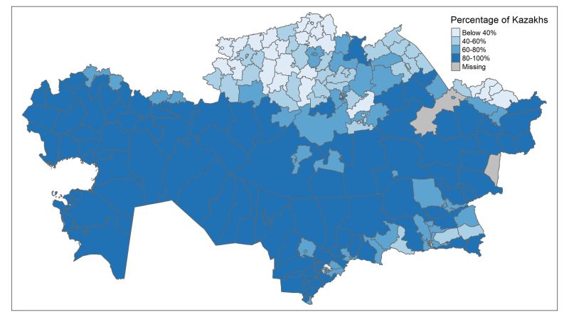
Percentage of Kazakhs by District | R
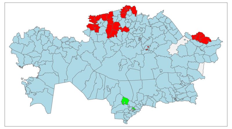
Ethnic Majorities Map | R
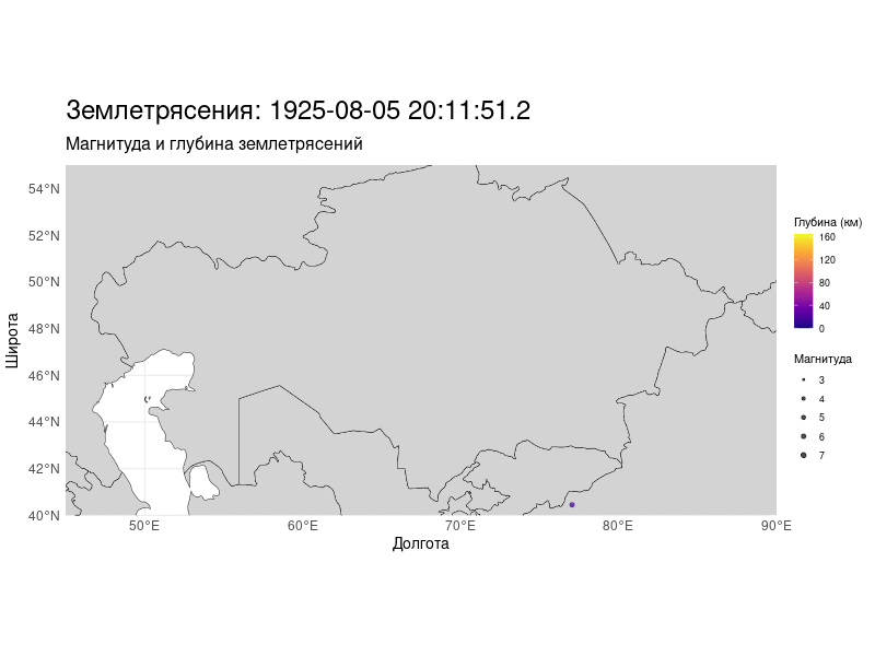
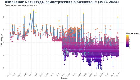
Chronology of Earthquakes in Kazakhstan | R
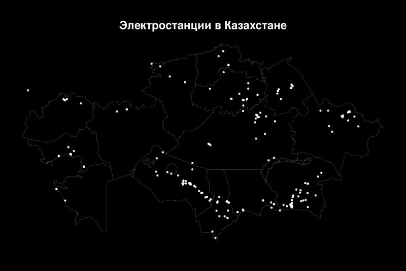
Power Plants in Kazakhstan | Python
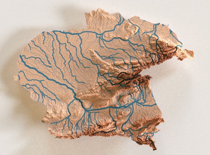
3D Map of Rivers | Geoanalysis R
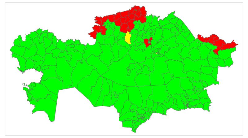
Natural Population Growth | R
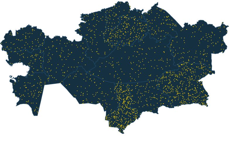
Population Dot Density Map of Kazakhstan | R
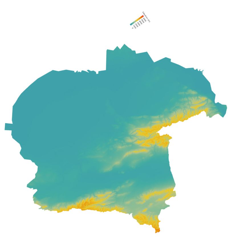
3D Relief Map of Almaty Region | R
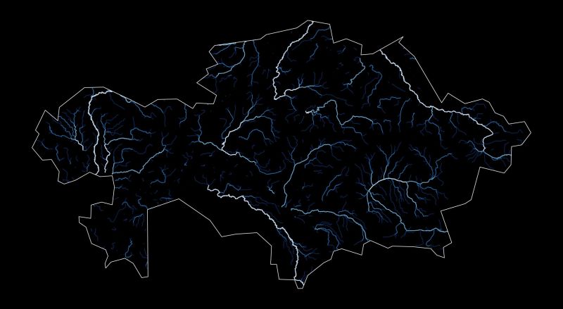
River Systems of Kazakhstan | R
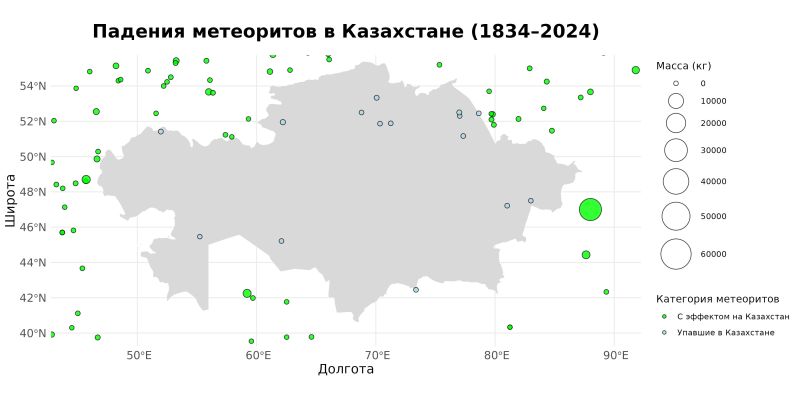
Meteorite Falls in Kazakhstan | R
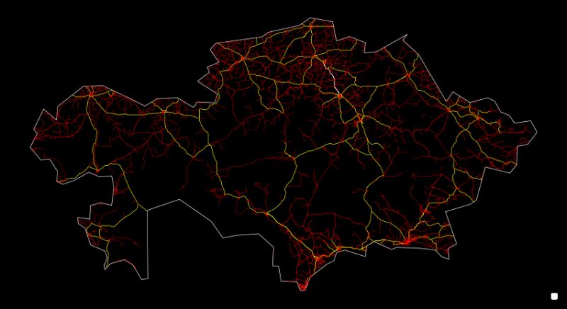
Road Network of Kazakhstan | R
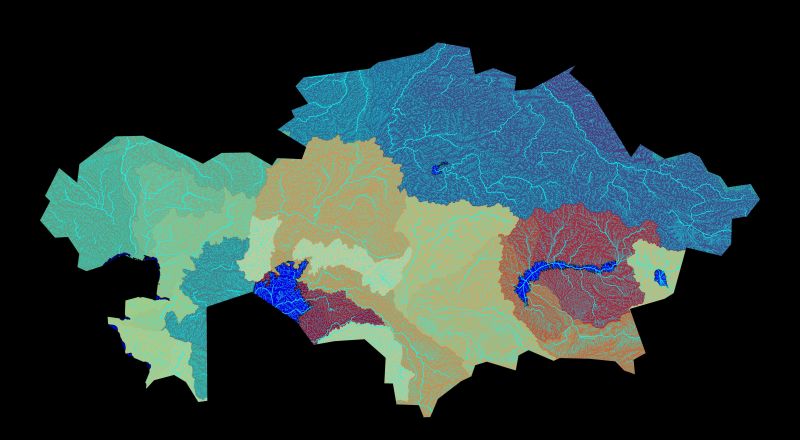
River Basins and Watersheds of Kazakhstan | Python
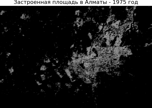
Urban Expansion of Almaty | Python
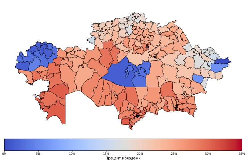
Youth Demographics Map | Python
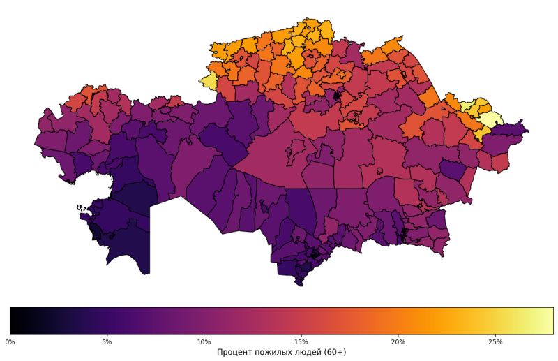
Elderly Demographics Map | Python
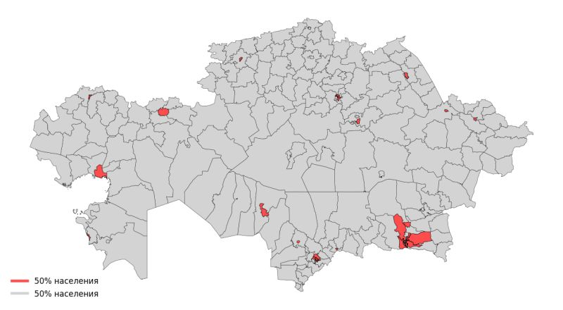
Population Distribution (50/50) | R